
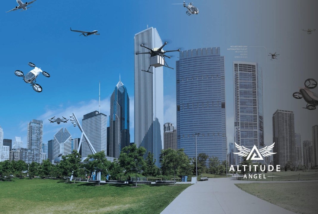
The UK is gearing up to unveil its first drone superhighway, developed by Altitude Angel, which is poised to transform aerial transportation.
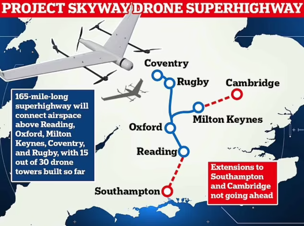
Scheduled to open this summer, the superhighway will span 165 miles, connecting Coventry to Milton Keynes and deploy 30 Arrow Towers for drone control.
Go deeper with GlobalData


Access deeper industry intelligence
Experience unmatched clarity with a single platform that combines unique data, AI, and human expertise.
According to Altitude Angel, when drones can navigate extended distances safely alongside other airspace users, they can be deployed more readily for critical tasks such as emergency response, search and rescue missions, transporting organs and medical supplies, and conducting surveys more safely and efficiently.
However, not everyone is on board with this groundbreaking initiative. Critics have raised concerns about potential privacy infringements and safety hazards for individuals residing beneath the path of the superhighway.
The prospect of drones autonomously buzzing overhead raises questions about noise pollution and intrusive surveillance. Despite assurances from Altitude Angel regarding the minimal impact on ground-level residents, scepticism persists.
At the heart of the superhighway’s operation are the 30 Arrow Towers, innovative structures designed to oversee drone traffic from the ground. These towers will establish a virtual corridor in the sky, guiding drones safely over long distances without direct human intervention.
Stephen Farmer, Altitude Angel’s head of corporate communications, highlighted the towers’ pivotal role, explaining that they enable drone navigation beyond traditional line-of-sight limits. He told the MailOnline: “At the moment, you need to see a drone and be within 500m to fly it.”
Equipped with advanced sensors, the towers create detailed aerial maps to ensure safe passage, facilitating drones to maintain safe distances and navigate around obstacles seamlessly.
Currently, half of the planned 30 towers, covering 80 to 90 miles, are operational for the UK’s drone superhighway. Initial plans aimed to extend the network towards Southampton and Bentwaters, but challenges in securing locations for new towers have led to the shelving of these expansions.
The MailOnline reported that the development of the drone superhighway is part of a broader £273 million government investment in the aerospace sector, supported by a £5 million contribution from BT Group. This financial backing underscores the project’s potential to drive economic growth, innovation, and improved public services.
Financing the drone evolution: sky-high challenges and opportunities